What are bugs saying about Flat Creek?

Shhh…if you listen carefully, you might hear the bugs in Flat Creek talking to you. Just kidding, but only partially. Benthic macroinvertebrates (aquatic bugs) are “canaries in the coalmine” for stream health because these little bugs are sensitive to changes in water quality and stream habitat.

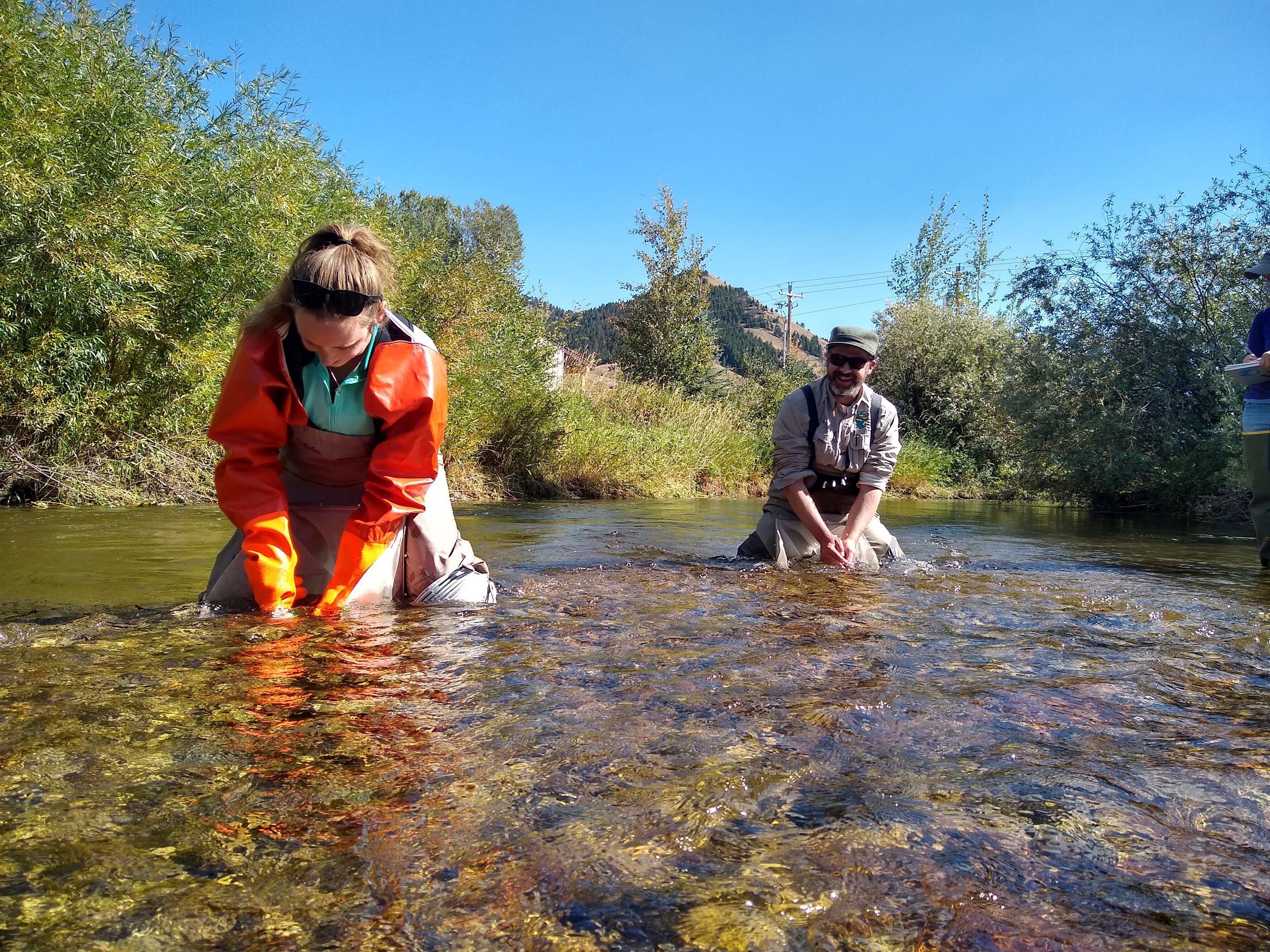
Emily Smith (left) and Carlin Girard (right) collect macroinvertebrate samples from Flat Creek.

Teton Conservation District uses a metric known as “EPT Richness” to assess stream health. EPT Richness is the abundance of three pollution-sensitive aquatic insect orders: Ephemeroptera (mayflies), Plecoptera (caddisflies), and Trichoptera (stoneflies).  

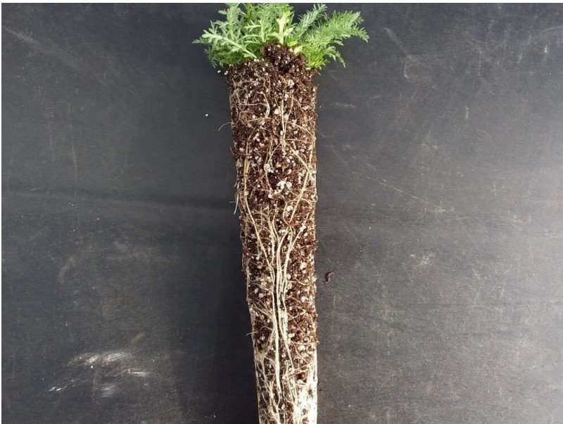
Flat Creek is designated by the Wyoming Department of Environmental Quality as an “impaired waterbody” due to increased sediment loads. Fine sediment clogs the spaces between cobbles in a streambed, reducing available habitat for macroinvertebrates and spawning native Snake River fine-spotted cutthroat trout. Some macroinvertebrates simply cannot live in water laden with sediment. To keep tabs on the health of the creek, Teton Conservation District staff wade out into Flat Creek annually to collect macroinvertebrate samples. These bugs have told us a lot about the health of Flat Creek since data collection began in 1996.  

It’s not all bad news! Since the installation of the Karns Meadow Stormwater Treatment Wetland in 2012, EPT Richness has steadily increased in Flat Creek. The constructed wetland—funded in part by Teton Conservation District—is designed to reduce sediment loads and polluted runoff from the town of Jackson. The wetland is doing its job quite well—after water moves through the wetland, it’s removed of about 90% of its contaminants! But in recent years, improvement in Flat Creek’s EPT Richness has slowed. One reason may be the above average water temperatures during the summer of 2021. We’re watching temperatures closely this year.

The plot above represents the number of species (or richness) of Ephemeroptera, Trichoptera, and Plecoptera (EPT) measured in Flat Creek since 1996. Teton Conservation District collects water quality and macroinvertebrate samples from Flat Creek as part of our annual sampling objectives.

There is much more work to be done to continue to improve water quality in Flat Creek. Teton Conservation District is supporting more water quality improvement projects, including the use of stormwater filtration units, on-site green infrastructure, and management of snow storage piles, all of which directly reduce the delivery of sediment to the creek.

What can you do to help? Chemicals, fertilizers, sediment, etc. that are deposited on our lawns, driveways, and roads ultimately run off into nearby creeks and rivers. Don’t let runoff from disturbed areas flow from your property. Consider what products you’re using and how they might impact waterbodies. Never dump things like oil, paint, or chemicals in the street or down a storm drain. Eliminate or reduce the use of fertilizer, pesticides, sand, salt, and harsh cleaning products. Our collective action can help improve water quality in Flat Creek.

How's the Hoback Running? Check out the new USGS Streamgage

Funded by USGS and private donations to the Snake River Fund, the streamgage is the result of a partnership between USGS, the Snake River Fund, and Teton Conservation District.

New Hoback River Streamgage. Photo: Jared Baecker // Snake River Fund.

After the warm and dry summer of 2021 and longer-term drought concerns, the organizations collectively recognized the importance of sharing streamflow and temperature data on the Hoback River with the public.

The Wild & Scenic Hoback River provides prime paddling for kayakers, packrafters and rafters during spring runoff. Once high water subsides, the river is an excellent wade fishing destination.

As an organization that promotes river recreation and public access, the Snake River Fund notes the new gage will help the paddling community by establishing flow data thresholds that will support the use of different types of watercraft. Additionally, the gage will inform anglers about the real-time water temperatures and allow for informed decision-making.

“During the heat of summer, catch and release anglers should understand the effects of river temperature on native Snake River fine-spotted cutthroat trout,” said Jared Baecker, executive director of Snake River Fund. “As waters warm into the upper 60-degree Fahrenheit range, hooked trout may experience elevated stress and struggle to cope with the rigors of being caught and released.”

The Hoback River is a free-flowing river for over 55 miles, and many of those miles are accessible from US Highway 191 as the river flows through the Bridger-Teton National Forest. David Lee, water resources specialist for Teton Conservation District, is looking forward to the public benefit the streamgage will bring to the community. “It’s important to establish a long-term, real-time, and continuous public dataset to support Bridger-Teton National Forest’s continued management of this river,” Lee said.

Teton Conservation District and USGS partner to maintain and operate several streamgages across Teton County. In addition to the Hoback River, Teton Conservation District provides ongoing funding for the streamgages on Fish Creek, Flat Creek, the Snake River and the Gros Ventre River. In 2022, the district funded the launch of continuous temperature sensors on the Snake River, the Buffalo Fork and Flat Creek.

Click here to view the real-time gage height, streamflow, and temperature data.

Teton Conservation Vision Award Celebrates Rob Dearing

Teton Conservation District is proud to announce that Rob Dearing is the recipient of the inaugural Teton Conservation Vision Award for his contributions to wildfire risk reduction in our community.

As a volunteer firefighter with Jackson Hole Fire/EMS for 18 years, Dearing has fought wildfires, protected homes, and captained the Adams Canyon Firehouse. He also volunteered his time to build Teton Conservation District’s Wildfire Risk Reduction Program alongside Robb Sgroi, Land Resources Specialist for the district. “In his typical friendly, constructive, thoughtful, and thorough manner, Rob helped envision our wildfire program, and in doing so directly enhanced both firefighter and resident safety,” says Sgroi.

Photos by Taylor Glenn, courtesy of Rob Dearing

The Teton Conservation Vision Award seeks to recognize people like Dearing whose vision influences the trajectory of conservation in our community. With Dearing’s guidance, the district’s wildfire program has served 392 properties and grown to include road corridor and common space wildfire risk reduction projects. Sgroi sincerely appreciates Dearing’s contributions beyond the district as well. “Rob’s Fire/EMS colleagues and friends are all effusive in their praise and gratitude for his dedication to our community. Jackson is a better place for the spirit of volunteerism that Rob has offered behind the scenes,” says Sgroi. Dearing has served our community while also raising two children and owning and operating Dearing Furniture Workshop.

As compensation for Rob’s significant contributions, this award will be accompanied by a $500 credit to the Slow Food of the Tetons year-round Online Marketplace. Slow Food of the Tetons Executive Director Scott Steen explains, “Mr. Dearing will be able to choose from the array of locally produced food from the 30 different vendors available through the Online Marketplace.”

Carlin Girard, Executive Director of the Teton Conservation District is proud to promote both the volunteer efforts of Rob Dearing and the production of local food. “Teton Conservation District is a partnering organization though-and-through. It is rare that we accomplish our goals without partner support,” he says. “Many of our partners carry a lot of weight, sometimes in their free time, to the benefit of the entire community. Rob Dearing is one of those people.” Carlin adds, “Conservation Districts are here to fill those important natural resources gaps, and wildfire risk reduction and increasing local food production are two of our large priorities. Congratulations Rob and thanks for helping us showcase and support these crucial community resources.”

Photos by Taylor Glenn, courtesy of Rob Dearing

State of the Snowpack

It’s been an interesting winter to watch our snowpack develop. From our massive New Year winter storm to the January and February dry spell, to the recent weeks of valley rain and mountain snow—we have certainly been hanging onto our hats this season.

The figure below represents our snowpack in comparison to last winter, the winter of 2017/2018, and the median snowpack. Snow water equivalent (SWE)— the amount of liquid water in the snowpack—is currently 89% of normal as of April 26. The median ‘peak date’ for this watershed—the date when snowpack is typically at its maximum—is April 12. This year, we have received 2.3 inches of SWE since that date, bringing our SWE closer to last year’s peak. The snowpack in the Upper Snake River watershed is measured using a combination of eight SNOTEL (Snow Telemetry) sites across the headwaters of the Snake River, from the Lewis Lake divide to Togwotee Pass.

Please the bees! Participate in our Perennial Pollinator Program

1) What is the Perennial Pollinator Program (PPP)? The PPP is a pilot partnership between Teton Conservation District and Piney Island Native Plants, a native plant nursery in Sheridan, WY. PPP participants will receive a variety pack of 35 individual rooted plugs with five different native plant species that are of high-value to pollinators (one pack of 35 = seven plugs of five species). Plants will be delivered in early June 2022. Supplies are limited to 50 total variety packs and will be sold on a first-come first-served basis.

2) Who is the Program for? Are you a fan of increasing the availability of food and shelter for bees, butterflies, and other pollinators?! This opportunity might be for you! Getting native plants established does require patience and commitment. Some of the flowers will not bloom in the first year but a successful summer 2022 planting will grow strong roots that will fuel summer 2023 (and beyond) flowers. Once established, native plants are well adapted to local precipitation, soil types, herbivory, and temperature regimes and require less or no fertilizer or water than commonly-available ornamentals. Please note this program is for small-scale planting purposes only. Plants are not intended for resale. Limited to residents of Teton County, WY.

Rooted plant plug.

3) What is a rooted native plant plug? A rooted plug is like a garden start. Instead of starting from seed, each plant will have a well-developed root system to increase chances of successful establishment. Each lot will contain five wrapped bundles of seven plugs each.

4) What species will I get? This year’s PPP program includes 1) Blanket Flower, 2) Rocky Mtn. Penstemon, 3) Smooth Aster, 4) Western Yarrow, and 5) Wild Bergamot. All species are native to Wyoming, offer a variety of colors, and will bloom between June and September once established. See pictures and more information about the species below.

5) How much space will one PPP lot cover? Planting design is a form of personal expression. For planning purposes, each plug will occupy approximately one square foot of garden space once established. Don’t worry if this looks sparse at first. Your plants will thank you for the space to expand in future growing seasons. One PPP lot will cover approximately 35 square feet of garden space.

6) How much does it cost? One variety pack consisting of 35 plugs (7x5 species) are available for $120.58 w/tax. Teton Conservation District is covering the cost of shipping (~$35) to Teton County.

7) How do I order? When/where will my order arrive? Contact Morgan Graham at 307-733-2110 or morgan<at>tetonconservation.org before May 21st, 2022 for order details. You will then pick up your order at Teton Conservation District (420 W. Pearl Ave.) in Jackson in early June. We will be in touch regarding the exact pick-up date.

8) Do I need a green thumb? Previous gardening experience is recommended. Enthusiasm and long-term commitment are required. Here are some tips to optimize chances of successful establishment:

  • Identify an area where your pollinator garden will receive ~8 hours of sun daily throughout the growing season.

  • Prepare your planting site by removing weeds/rocks and break up compacted soil.

  • Consider amending your soil by blending in an organic compost.

  • Ensure plugs are kept moist and out of direct sun between pickup and planting.

  • When planting, take care that the root crown is flush with the soil surface (not too high or too low).

  • Plant plugs on a cloudy day or in the early or late part of the day when temperatures are cooler.

  • Scrape walls of planting hole to help roots grow out laterally.

  • Water plugs immediately after planting to remove air holes.

  • Add 2-4” of medium texture (grass clippings, shredded leaves, weed-free straw) mulch to planting bed.

  • Water plugs deeply once every 3-4 days for the first month. Adjust watering if plants appear stressed during extended dry periods in the first growing season.

  • Time spent weeding in years one and two will reap huge dividends in the future.

9) What else do I need to know? Our hope is that participants in the PPP will share their contact information with Teton Conservation District. We are committed to promoting the benefits of low-input native plant landscaping. Let us share future native plant/pollinator opportunities with you and amplify your successes and lessons learned!


Blanket Flower Gaillardia aristata

Size: 8-24" tall, 12" wide Bloom Time: June-September Bloom Color: Yellow, orange, red Minimum Precip (inches): 10+ Light: Full sun Soil Conditions: Does well on a variety of well-drained soils Pollinators: Bees and butterflies Wildlife Value: Young and adult upland game birds Misc: Drought tolerant


Rocky Mountain Penstemon Penstemon strictus

Size: 18-30" tall, 12-36" wide Bloom Time: June-July Bloom Color: Purple/Blue Minimum Precip (inches): 10+ Light: Full to part sun Soil Conditions: Moderately fine to coarse; well-drained Pollinators: Bees, hummingbirds Wildlife Value: Forage for deer, antelope, and birds; cover for small bird species Misc: Semi-evergreen perennial; excellent cold winter and drought tolerance


Western Yarrow Achillea millefolium var. occidentalis

Size: 12-40" tall, 12-24" wide Bloom Time: June-September Bloom Color: White Minimum Precip (inches): 8+ Light: Full to part sun Soil Conditions: Tolerates most soils Pollinators: Bees and butterflies Wildlife Value: Food source for antelope, deer, sage grouse and other upland birds Misc: Highly adaptable and drought tolerant wildflower. Rhizomatous spreader.


Wild bergamot (Bee balm) Monarda fistulosa

Size: 12-40" tall Bloom Time: June-September Bloom Color: Pale purple to rose pink Minimum Precip (inches): 20+ Light: Full to part sun Soil Conditions: Wide range of soils Pollinators: Bees, butterflies and hummingbirds Wildlife Value: See pollinators above. Otherwise, Wild Bergamot is deer resistant! Misc: Edible; many past medicinal uses


Smooth Aster Symphyotrichum laeve

Size: 12-39" tall Bloom Time: August-October Bloom Color: Purple Minimum Precip (inches): 15+ Light: Full to part sun Soil Conditions: Wide adaptation Pollinators: Bees and butterflies Wildlife Value: Host plant for Pearl Crescent butterfly, seeds are a food source for songbirds and small mammals.  Misc: Provides shelter for butterflies.

Morgan's Nature Notebook - Episode 12 - Edmiston Spring

Whelp, the snow sure is going fast…but where’s it all going?

Snowmelt runs off into waterbodies, carrying pollutants such as sediment, hydrocarbons, and other contaminants left on our roadways and parking lots along with it. Sediment, while it may sound harmless, can clog up the loose gravel streambed that native cutthroat trout and macroinvertebrates need to reproduce.

In Episode 12, Morgan finds a long-lost friend and meets up with Derek Ellis with Jackson Hole Land Trust and David Lee with Teton Conservation District to learn about Edmiston Spring and how to estimate the amount of sediment in a snow pile.

Numerous classrooms in Teton County have done this activity as part of curriculum – drop us a line if your class is interested in doing this project at info@tetonconservation.org.

Bighorn Sheep Nutrition & Disease

Pneumonia is often the culprit for massive bighorn sheep population crashes. But infected herds can experience very different population trends—some continue to decline, some undergo crash-recovery cycles, and some are able to tolerate it without significant mortality. Why?

With funding support from Teton Conservation District, Brittany Wagler and Rachel Smiley, graduate students at the University of Wyoming, and their advisor, Dr. Kevin Monteith, have been studying whether nutrition may be at play. Their work focuses on the Whiskey Mountain (Dubois), Jackson, and Cody bighorn sheep herds, which all hold the same bacterial pathogens associated with pneumonia but have much different population trends.

Brittany and Rachel are tracking presence of pathogens, nutritional condition, reproduction, adult and lamb survival, mortality causes, and forage conditions of individuals over time. Conclusions have not been drawn from their research yet, but they’re working to disentangle the relative roles of each of those factors in crashes and recoveries of bighorn sheep populations. When complete, their research will improve our understanding of pneumonia, help develop management options for bighorn sheep, and ultimately, further mountain sheep conservation.

Photo credits: monteithshop.org

Meet the Staff: David Lee

Sometimes David brings companions into the mountains, including Pepper the Schipperke.

Meet David Lee, our newest staff member here at Teton Conservation District!

As our Water Resources Specialist, you might meet David in our office selling well test kits, at a presentation on water quality information, or in the field sampling one of our many beautiful streams. David originates from central Florida, where he received a B.S. in Environmental Engineering from the University of Florida. He was drawn out west to Colorado and California where he worked for federal agencies conducting riparian restoration projects and protecting and managing wilderness areas. After receiving an M.S. in Forest Hydrology and Watershed Management from Virginia Polytechnic and State University, David again found himself in the western U.S. performing hydrology work for federal agencies, including the Bridger-Teton National Forest in 2019. He’s happy to be back in Jackson and is passionate about working on watershed protection in Teton County. Want to learn more about David? Enjoy this Q&A with him!

David contemplating the ever-changing weather in Rocky Mountain National Park.

Why did you decide to purse a degree and career in water resources?

I have been excited about water since I was a little kid. I grew up paddling and fishing and have always been drawn to the idea of protecting “wet” spaces. During my undergraduate degree, I was able to work with one of my professors on a water availability project on a longleaf pine plantation, and I was immediately hooked. I saw the importance of understanding the dynamic challenges brought forward by water quantity and quality issues. I also saw how invested everyone was in finding appropriate solutions. It gave me a sense of optimism that the problems we face are solvable.

What do you like about your job?

I love that this position allows me to work with so many different groups of people. I think that diverse minds can have significant positive impacts on the community, whether  by working with partners on restoration projects, communicating with residents about water quality, or providing insight on ways to improve water quality in Jackson Hole.

What are some challenges you face in your work?

Managing deadlines and planning for opportunities that extend far into the future can be challenging. It is a good opportunity for me to look ahead with a clear mind.

If you could have a different career, what would it be?

I’ve always thought that meteorology was fascinating. Storm-chasing, forecasting, modeling, you name it. Maybe I’ll incorporate that into my next life.

If we could only have one season forever, which season would you pick and why?

It would easily be spring. I’ve always been in love with watching the annual green-up. And the skiing is still good, creeks start to rise, weather gets warmer…it’s all a perfect mix for me.

David enjoying a well-earned view from the summit block of Cathedral Peak.

What’s the coolest wildlife encounter you’ve ever had?

We were paddling on a spring-fed creek in north Florida, and we happened to pass an alligator. It was a large bull, laying on a log submerged in the water. During mating season, males will let out low, sustained growls to attract mates and ward off other males. We happened to see this up close (from a respectable distance away—the opposite bank). The alligator’s body shook the water surface violently, rippling the water and sending waves across the creek. To this day I think about how our boat shook from his growl.

Do you want to share an embarrassing memory with us?  

My mom was a real estate agent when I was very young, and I remember going to one of her showings with her. The house had no furnishings of any kind. I ended up playing around the pool with my sister and falling in (what can I say; I’ve always loved water!), forcing me to stand in my underwear and air-dry in front of the potential buyers. Thankfully I don’t think it spooked them too much; they still bought the house.


Feeling quite small in Lavender Col.


Tavner Wilson Conducts Soil Health Experiment in Alta

What happens to soil health if cropland is left to rest for a year?

Tavner Wilson, who owns and operates Bar W Agriculture with his family in Alta, Wyoming, wanted to find out. With a grant from Teton Conservation District, Tavner set aside eight acres in the summer of 2020 to experiment with a cover crop seed mix and till and no-till practices. A cover crop is grown with the goal of enriching soil, compared to a cash crop which is grown for commercial value. Tavner’s cover crop was a diverse mix of berseem clover, spring forage peas, chickling vetch, spring oats, teff grass, spring triticale, purple top turnips, smart radish, bayou kale, plantain, and safflower.

Tavner had some interesting observations throughout the year, including sheaths of soil remaining attached to the plant roots growing in the experimental plots (see photo on left below). “This is a positive sign,” explains Tavner, “it’s an indication of biological and microbial activity in the soil, and also indicates the plant has more of a relationship with the soil than it might otherwise have.”

July 4, 2020. Photo courtesy of Tavner Wilson.

July 4, 2020. Photo courtesy of Tavner Wilson.

With assistance from Friends of the Teton River, Tavner did soil tests before and after the experiment to assess the change in organic matter, soil respiration, and other soil nutrients. While soil health regeneration takes years to develop, Tavner saw significant changes between the 2020 and 2021 soil test results:

  • Soil respiration due to microbial activity increased by 88%

  • Microbially-active carbon increased by 55%

  • Organic Nitrogen increased by 108%

  • Organic Carbon decreased by 16%

  • Organic C:N ratio decreased by 61%

  • Nitrogen available the next year’s crop increased by 91%

  • Organic matter increased by 5%

  • Overall soil health calculation increased by 47%

Tavner hopes this demonstration project will help him and others reduce costs and the need for synthetic fertilizers and improve retained carbon, organic matter, and water holding capacity in the soil in the future. To dig into Tavner’s project more, check out his highlighted stories on Instagram @tavnerwil.

Do you have an interesting conservation project? We’re accepting grant applications until 5pm on February 1. Click here to learn more.

July 12, 2020. Photo courtesy of Tavner Wilson.

July 12, 2020. Photo courtesy of Tavner Wilson.

July 30, 2020. Photo courtesy of Tavner Wilson.

July 30, 2020. Photo courtesy of Tavner Wilson.

August 8, 2020. Photo courtesy of Tavner Wilson.

August 27, 2020. Photo courtesy of Tavner Wilson.

Morgan's Nature Notebook - Episode 11 - Grouse in the House

Happy Holidays Friends! Ohhhh do we have a special edition of Morgan’s Nature Notebook for you – Grouse in the House! Did you know we have four species of grouse in Teton County? Sage grouse get all the attention, but the other three species are pretty cool too! Bonus feature – stay tuned until the end of the episode for our first-ever music video! (We know another 12 Days parody isn’t everyone’s cup of eggnog – no hard feelings if you fast-forward to the finale!) And special thanks to Morgan Graham for spending the last two weekends working on this song – safe to say that seldom few love grouse as much as Morgan.

Sing along with us!

In the ______ Nature Notebook, the Tetons gave to me:

Twelve sharpies stamping

Eleven sage grouse strutting

Ten chokecherries changing

Nine chicka-dee-dees

Eight curlews courting

Seven slopes for skiing

Six moose a-munching

Five Wild rose

Four sparking embers

Three native bees

Two great green gentian,

And a ruffed grouse in a fir tree.

Special thanks to Lang Elliott, Bob McGuire, Zach Andres, and Mark Thonhoff for generously providing additional grouse footage and sounds.  

Why Should I Care About Winter Range?

By Morgan Graham

Growing up in Pennsylvania, I was not intimately familiar with the concept of winter range. Seasonal shifts were marked by hundreds of Canada geese gorging on leftover corn and soybeans. Over time more and more of those migrating geese became yearlong residents, displacing other waterfowl and depositing metric tons of green slipping hazards on sports fields…but that’s a different story.

Winter range showed up on my radar in a big way during my first winter in Jackson in 2006. As part of a field technician position, I counted mule deer on winter range from 27 fixed locations around the valley twice a week. Over the following three winters, I listened to a lot of Trash and Treasure, documented 3,230 animals across 417 locations, and developed a greater appreciation for winter range. Monitoring conservation easements, conducting habitat inventories, and 15 seasons exploring public lands have deepened my understanding of why winter range is important.

Winter range mule deer observations above Broadway Avenue, symbolized by deer group size.

So, what’s winter range anyway and why should you care about it?

The lack of winter range is widely recognized as one of the most significant limiting factors to mule deer populations. Winter range is the topography, and habitat that mule deer require to survive deep snow, frigid temperatures, predation threats, and human-caused stress. The winter range we see animals using most frequently are the steep south-, east-, and west-facing buttes that receive enough sun and wind to keep snow depths low and natural high-fiber forage accessible, like mountain big sagebrush, Rocky Mountain juniper, antelope bitterbrush, rubber rabbitbrush, Wood’s rose, mountain snowberry, and curlleaf mountain mahogany. It also includes older, closed-canopy stands of Douglas fir and lodgepole pine that shield against heavy snow and cold wind.

When I was a young buck, my body mass could fluctuate by 15% over the year (mule deer bucks can lose 15% of their body mass during the rut alone!). A steady winter diet of beer, pizza, and Netflix transitioning to a summer diet of sunshine, water, and plants would typically put me at my heaviest in April and lightest in October. Mule deer are the opposite. Their fat levels may increase from around 9% in June to 25% in December. They then rely on those fat stores until May when the landscape begins to green up again. If they run out, their body will shift to burning protein/muscle (not good). A dog chasing a deer through deep snow has negative consequences―travel through snow can require 6x more energy than flat ground. What’s harder to reckon are the cumulative impacts of more frequent alertness, standing, and walking in response to humans and pets. Each act of avoidance is a debit on a deer’s fat stores. The best thing you can do is keep your dog under control and observe seasonal wildlife closures. Even if there isn’t snow on the ground, the deer appreciate the space to chill.

So, why don’t we just feed deer the same way we feed elk? There are plenty of biological, social, and behavioral reasons, but the simplest is that it can kill them. Mule deer have evolved to “stomach” our long winters. Deer are heavily reliant on rumen bacteria that adjust seasonally to the foods that are available on the landscape. By the time winter rolls around, a deer’s rumen has acclimated to handle high-fiber, low-protein food. Suddenly dumping high-protein or high-carb fuel like hay or corn in the tank is equivalent to putting gasoline in a diesel engine (also not good). If you want to provide food for wildlife, consider maintaining or restoring some of the native plants listed above in areas away from buildings and roads.

Organizations like Jackson Hole Wildlife Foundation play an invaluable role in amplifying the importance of crucial habitats like mule deer winter range. If you want to help, consider sharing some of the concepts of this post with friends or become a certified Nature Mapper and start logging observations of all sorts of critters on winter and other seasonal ranges.

Morgan is the Geographic Information Systems (GIS) & Wildlife Specialist for Teton Conservation District. He is grateful for the opportunity to behold and share the hidden gems of the Greater Yellowstone Ecosystem with friends, family, and curious strangers. Follow along @morganser and @tetonconservation or send him notes or questions at morgan@tetonconservation.org.

New Educational Sign Celebrates Karns Meadow

Though many of us pass by Karns Meadow Park every day, it’s not well known that this wetland system filters the largest stormwater pollutant load to Flat Creek. There’s a new interpretive sign by artist Katie Christiansen at the corner of Flat Creek Drive and Snow King Avenue that tells the story of the Karns Meadow wetland. Join us at 2:00 p.m. on Wednesday, December 8, 2021 for the sign ribbon-cutting and remarks by Mayor Hailey Morton Levinson and Town of Jackson and Teton Conservation District staff.


“Nestled within Jackson’s bustling valley floor and between habitat-rich hillsides, Karns Meadow is a small but mighty wild area set aside for ecosystem health,” reads the sign. Constructed in 2011, the stormwater treatment ponds on the east side of the meadow capture and treat stormwater runoff from roughly 27% of the town of Jackson, which carries sediment, salts, metals, hydrocarbons, and other pollutants with it. After this water moves through the wetland, about 90% of its contaminants have been stripped away, significantly improving the physical and chemical quality of the runoff entering Flat Creek.

With a grant from the Wyoming Department of Agriculture, a local group including Teton Conservation District, Town of Jackson, and the Jackson Hole Land Trust set out to highlight the 40-acre treatment wetland hidden in plain sight in the center of town. Floren Poliseo, Director of Public Works for the Town of Jackson, says “The fact that these types of projects were envisioned over a decade ago is a testament to Jackson’s commitment to the ecological resources and habitat that define our region and community character. I hope to integrate more projects that address both human and natural world needs into the Town’s infrastructure systems.”

Artist and naturalist Katie Christiansen was selected to create the captivating sign. Christiansen specializes in creating artful interpretive installations in parks and protected areas across the region. She is also the editor of the recently released book, The Artist’s Field Guide to Yellowstone. “The sign at Karns Meadow presented a unique opportunity to showcase an often overlooked and yet critical natural area in the valley,” says Christiansen. “I hope that the final installation, by beautifully conveying both the ecological and community values of the park, will meaningfully connect people with and encourage continued stewardship of the natural world right before them.”

“The Karns Meadow Stormwater Treatment Wetland exemplifies the community’s work to steward our water resources using the wetland system to benefit water quality and the many species that rely on Flat Creek’s riparian area,” says Carlin Girard, Executive Director at Teton Conservation District. “I am thrilled to help showcase this excellent project because many of our efforts are hidden under streets or on private lands. The biological data being collected on Flat Creek is very encouraging—sensitive species are returning to Flat Creek, and with more improvement projects on the horizon, we are heading in the right direction.”

The installation of this new sign coincides with the 15th anniversary of the original Flat Creek Watershed Management Plan, which set goals to improve Flat Creek by addressing stormwater runoff and stream habitat degradation. Since then, 20 of the 22 objectives outlined in the plan—including Karns Stormwater Wetland—have been completed. In 2019, Teton Conservation District released a new Flat Creek Watershed Management Plan, which outlines actionable projects and goals for the future. Some of the projects identified in the new plan are already underway, including characterizing the Town of Jackson’s sediment pollution load, implementing overarching stormwater management planning, adding stormwater treatment to untreated portions of the underground pipe system, and treating runoff onsite before it leaves properties.

Wilson Neighborhood Recognized for Wildfire Risk Reduction

Arborists from Arbor Works Tree Service remove vegetation along a road corridor in Hidden Hills Ranches. Photo by Greg Nelson.

Hidden Hills Ranches, a subdivision south of Wilson, was recently recognized as a Firewise® USA site—a National Fire Protection Association program that recognizes neighborhoods for taking proactive steps to reduce the risk of property damage from wildfire and improve safety for residents and firefighters. The Hidden Hills neighborhood exceeded the expectations of the program after years of effort and implementing numerous wildfire risk reduction projects, with the support of local and regional partners including Jackson Fire/EMS, Bridger-Teton National Forest, Wyoming State Forestry Division, and Teton Conservation District.

 Hidden Hills resident Greg Nelson, also a Teton Wildfire Ambassador, has spent countless days planning and leading projects to make his neighborhood more fire resilient, including obtaining a Wyoming State Forestry Division grant to support fuels reduction at 18 properties. Other efforts included vegetation management along road corridors, and 11 homes participated in Teton Conservation District’s Wildfire Risk Reduction Program—a program that offers free, voluntary recommendations to reduce the risk of wildfire and grant funding to implement those recommendations. Cumulatively, the neighborhood has invested hundreds of hours into wildfire risk reduction efforts.

 “Becoming a Firewise community is no small effort—we thank Greg Nelson and his Hidden Hills neighbors for all they’ve done to enhance their safety, firefighter safety, and forest health,” says Bobbi Clauson, Wildland Fire Prevention Specialist for Jackson Hole Fire/EMS. “We can already see neighboring subdivisions gaining momentum from witnessing Hidden Hill’s successes.”

Project during and after photos to reduce vegetation along roads. Photo by Greg Nelson.

Hidden Hills is surrounded by forest and is within the Wildland Urban Interface—an area designated by Teton County as being at greater risk for wildfire. Wildfire risk reduction work has also been completed on adjacent Bridger-Teton National Forest lands as part of the Teton to Snake Fuels Reduction project. “While interagency wildland firefighters implemented fuels reduction projects on wildlands, the neighbors of Hidden Hills have worked diligently assessing homes, designing mitigation strategies, cutting trees, chipping vegetation, and burning slash piles on their properties to help reduce vegetation on the private side of the fence,” says Lesley Williams-Gomez, Fire Prevention and Education Specialist for the North Zone of the Bridger-Teton National Forest. “This combined effort in fuels mitigation has created a safe and defensible space for firefighters responding to a wildland fire within the vicinity of their homes.”

Shane Rothman and David Quellhorst contributing to fuels reduction work in their neighborhood common space. Photo by Greg Nelson.

But the work for Hidden Hills is not over. The neighborhood intends to maintain its Firewise® USA status and is planning future projects including annual road corridor maintenance and water sources for fire suppression. “The certification of Hidden Hills as a Firewise USA community was driven by the engagement of the homeowners, willingness to embrace fuels treatments, and a commitment to continue to improve fire readiness. Their passion and commitment made the certification possible,” says Barry Tye of Wyoming State Forestry Division.

To learn more about participating in the Firewise program or to learn more about other wildfire risk reduction actions you can take at your home or in your neighborhood, reach out to Bobbi Clauson, Wildland Fire Prevention Specialist, at 307-732-8588 or bclauson@tetoncountywy.gov.

5th Graders Stoked on Stewardship

Morgan Graham (Teton Conservation District), Meta Dittmer (Teton County Weed & Pest), Kari Cieszkiewicz (National Elk Refuge)

Munger Mountain 5th graders are stoked on pulling weeds! Sixty students teamed up with Teton County Weed & Pest District and the National Elk Refuge to learn about wildlife habitat and pull 100+ pounds of invasive weeds around their school. 

Over a series of field-based lessons, students learned about ecosystem processes and how to identify native and invasive plants. Following a field trip to an ecologically-intact site, they visited a school field that was disturbed by construction. In their own words, students described how the abundance and diversity of plants and wildlife was lower around the school.

Then, each class was asked how they could improve wildlife habitat around their school.

The students’ enthusiastic answer: “GET RID OF THE INVASVE PLANTS!!!” They pulled thistles, houndstongue, scentless chamomile, and other weeds…and because Jackson kids are tough, they did this during the first winter precipitation of the season! For the biggest common mallow, a team of kids pulled together like a game of tug-o-war, cheering and laughing when they triumphed over the tap root. As the piles of weeds grew bigger and bigger, the cumulative impact energized the kids even more.

Morgan Graham cultivating enthusiasm for eradicating weeds!

The students communicated the importance of being stewards of the habitat around their school and want to pass that value down to younger classes. Most people say they love wildlife…but not everyone knows what to do to help wildlife. These 5th graders figured it out pretty quick—their enthusiasm to help the ladybugs, butterflies, birds, and all the critters is contagious. We hope you catch the bug through this post—it’s not too late to get out there and pull some weeds this season!

Educators and students are excited to continue the project this winter with a mapping exercise to plan future restoration projects.

Meta Dittmer showing a houndstongue to students.

Kari Cieszkiewicz cutting down a musk thistle after all of the seeds were removed.

Students remove musk seed thistle heads.

What's the Ruehling on Fish and Flat Creeks?

Kelsey Ruehling (left) and field technician Emma Román, a senior at Middlebury college, collect water samples in Fish Creek in summer 2021.

University of Wyoming Master’s student Kelsey Ruehling (pronounced ‘ruling’) is on a mission to find out where microbial pollution in Fish Creek and Flat Creek is originating from.

Sections of both creeks were designated as “impaired” by the Wyoming Department of Environmental Quality in 2020 for Escherichia coli (E. coli), a bacteria found in the intestines of all mammals, including humans. There are more than 700 strains of E. coli which are expelled into the environment by their warm-blooded hosts through fecal matter. Most strains are either harmless or benefit a healthy digestive track, however, certain pathogenic strains of E. coli can cause stomach cramps, nausea, vomiting, and diarrhea. Because E. coli can be cultured quickly and inexpensively in a laboratory, these bacteria are often used by scientists as a proxy or indicator for fecal contamination and the presence of pathogens. The risk of illness from ingesting a pathogenic strain of E. coli or another fecal pathogen is why sections of Fish and Flat Creeks exceed recreational use standards, which means they are not considered safe by the Wyoming Department of Environmental Quality for full-body contact. 

In order to best mitigate sources of microbial pollution, we need current research to understand where it’s coming from. Kelsey spent the summer regularly sampling four sites on Fish Creek and seven sites on Flat Creek and its tributaries (Game and Cache Creeks). She also collected about 100 fecal samples near stream sites to identify which species may be contributing fecal bacteria to streams. Kelsey used two EPA-approved methods to quantify E. coli and extracted DNA from the water and fecal samples to characterize their bacterial communities. Kelsey hopes that studying E. coli and the bacterial community as a whole will improve our understanding of what kinds of fecal matter may be contributing to elevated levels of E. coli and other pathogenic bacteria in Flat and Fish Creeks.

Kelsey and Emma measure streamflow velocity at intervals across the creek.

“Kelsey’s research fills a much-needed data gap—where is fecal contamination in Fish Creek and Flat Creek coming from? Currently, we can guess or we can use 15-year-old data, but in the end, this research that will allow time and money to be allocated efficiently and generate the result we all want—water that is safe for humans, pets, and wildlife,” says Carlin Girard, Water Resources Specialist for Teton Conservation District.

The last time E. coli research was conducted in Fish Creek was in the early 2000s—that study found that over 50% of the E. coli load in the stream originated from avian, rodent, and deer/elk species. Less than 20% originated from sources related to human activities, including 7% from dogs, 6% from wastewater, 4% from bovines, and 2% from horses.

Kelsey completed data collection in summer 2021. She’ll spend this winter analyzing data and writing her thesis. Check back in to read about the results from Kelsey’s study in 2022.

Learn more about Kelsey’s research at www.kelseyruehling.weebly.com. This research is supported by Teton Conservation District, the Wyoming Water Research Program, Jackson Hole One Fly, University of Wyoming, and U.S. Geological Survey. 

Tom Segerstrom to Retire, Carlin Girard Welcomed as New Executive Director

Tom Segerstrom

Tom Segerstrom

Tom Segerstrom is retiring from his role as Teton Conservation District’s Executive Director after leading the District for six years. Carlin Girard, Teton Conservation District’s Water Resources Specialist & Associate Director, was selected as the new Executive Director.

“Over the past 15 years, I’ve witnessed Teton Conservation District’s community presence and partnerships grow, along with the caliber of our programs,” says Tom. “I’m proud to have participated in and help shape this culture—and it’s with great gratitude to our staff and board for making my time with the District, personally, very rewarding.”  

Prior to joining the District staff as Executive Director, Tom served on the Teton Conservation District Board from 2004 to 2015, including a term as Board Chair from 2011 to 2013. As a certified wildlife biologist, Tom was a District Biologist for Wyoming Game and Fish Department for six years, pioneered the local ecotourism industry, and worked for 15 years as a Land Steward and Staff Biologist for the Jackson Hole Land Trust.

Tom has served on several boards, including President of the Wyoming Chapter of the Wildlife Society, Chair of the Teton County Natural Resource Technical Advisory Board, Teton County Library, Wyoming Wildlife Federation, and Jackson Hole Wildlife Foundation. He is also a longstanding member of the noon Rotary Club.

Carlin Girard

Carlin Girard

Carlin Girard began at Teton Conservation District in 2014 as the Water Resources Specialist and gained the additional role of Associate Director in 2019. “Carlin is fully capable and well-suited to lead this local branch of government to become an even more significant resource for the community,” said Steve McDonald, Board Chair.  

Carlin built a successful Water Program with a focus on conserving the ecology of the Snake River Watershed through research, technical expertise, partnerships, and outreach. Carlin has a strong background in native fisheries, aquatic and riparian habitat, and surface water quality. As Carlin’s understanding of the local water systems increased, he expanded his focus to drinking water and wastewater, drawing the community’s attention to nitrate in groundwater and the need for regional water planning.

“I am honored to have been chosen as Executive Director, especially given the excellent position Tom has led us to.” Carlin emphasized that “the staff and board have clear direction and a strong working relationship, but we are also uniquely capable of adapting to community needs. We are this community’s partner for natural resource conservation projects, and I encourage members of the public, agencies, whomever, to reach out so we can help get your projects on the ground.”

Prior to joining Teton Conservation District, Carlin spent eight years working in natural resource management and research, including with Wyoming Game and Fish Department and Oregon Department of Fish and Wildlife, among many others. He is experienced in database management, statistics, and GIS mapping and analysis. He has worked with ungulates, waterfowl, passerines, raptors and a wide range of vegetation communities. Carlin has published peer-reviewed articles and technical reports and holds a Master of Science degree in Aquatic Resource Management from the University of Wyoming. Through Carlin’s work in Wyoming and the region, he has built strong partnerships with researchers, natural resource managers, landowners, and community leaders.

Top row left to right: Tom Segerstrom, Emily Hagedorn-Wegher, Emily Smith, Carlin Girard, Phoebe Coburn

Bottom row left to right: Robb Sgroi, Morgan Graham

Carlin and Tom in front of Teton Conservation District

DroughtReach Part II: Teton County is in Severe Drought

By Carlin Girard, Water Resources Specialist & Associate Director


OVERVIEW

Hello Teton County, Wyoming, it’s your local Teton Conservation District telling you it’s time to think about how we are using our water. We are a facing a record low water year, and seeing a record year for water use. We need to limit wasteful water consumption for landscaping and in our homes.

The western third of the United States is experiencing drought, and while Teton County isn’t experiencing worst case “Exceptional Drought” conditions like the desert southwest, our county is in “Severe Drought”. But what does that mean, and what should we be doing about it? We hope to answer some of these questions by presenting data and anecdotes, and we will offer some tried and true methods to reduce water consumption.

The Exceptional Drought conditions throughout the west really are no joke. This summer, Lake Mead, our Nation’s largest reservoir, hit all-time lows since its establishment in 1930. To reduce water use, counties in Nevada have begun banning ornamental grass that does not serve a direct purpose. And closer to home, JH Daily reported on June 15th, 2021, that Sun Valley Idaho’s Wood River ran so low this spring that its Magic Reservoir had to stop delivering irrigation water to the 36,000 acres of farmland that it supports, which is the earliest the reservoir had been drawn down completely since at least 1977.

By early April 2021, 100% of Teton County, Wyoming was classified as being in drought, and in mid- July, all portions of Teton County were upgraded to Severe Drought. Severe Drought conditions are defined by areas experiencing poor pasture conditions; overgrazing is reported; hay is scarce; producers are selling cattle; dust increases; trees and vegetation are stressed; water pressure is low; and, well levels decline. This tracks with what we are seeing in Teton County.

The Natural Resources Conservation Service reports that as of July 12th, 2021 the Upper Snake River Basin has received 79% of normal precipitation for this water year, which began October 1, 2020. Winter snowpack drives this region’s hydrology and based on meteorologist Jim Woodmencey’s analysis, this year’s meager snowpack encountered a dry spring and early summer, with cooler than normal temperatures from January through most of May being followed by much warmer than normal temperatures from late May through June 2021.


SURFACE WATER

The spring and early summer weather made quick work of the snowpack, melting out our high elevation water storage weeks prior to its typical disappearance. Very dry soil conditions that were present from last fall absorbed some of that water, sublimation (evaporation from snow to air) took its share, and the rest produced a quick but near average snowmelt runoff peak in our streams and rivers. The looser in this scenario is summer baseflows in our streams and rivers.

Of our many streams and rivers that have real-time USGS flow gages, we see that most are now either setting 30-year record lows for this time period or are about to. While historical data shows that streamflows have been this low before, these low flows coincide with times of severe drought. Unless a significant change occurs in precipitation regimes, there is no reason to believe that low flows in our rivers’ and their tributaries will increase. Instead, what we can expect is low flows, high stream temperatures, and difficult over-wintering conditions for our native fisheries due to restricted habitat availability. USGS temperature data shows that Flat Creek and the Snake River are nearing 10-year record highs for this time period, and are near or above the 70-degree threshold known to be stressful for cutthroat trout.

Discharge: USGS stream gage discharge data from some of our Upper Snake River gages. Click on the plot to expand it full-screen.

Max. Temperatures: Panel: An analysis of maximum temperatures at four gages that have temperature monitoring. Click on the plot to expand it full-screen.


GROUNDWATER

USGS Well at Jackson Hole Airport: This provides an analysis of groundwater water levels upgradient from the Jackson Hole Airport.

Drought is something that we should expect from time-to-time, but we should also expect the resulting decrease in water availability. And in Teton County, Wyoming, our surface waters are important for irrigation, aquatic ecosystems, and recreation, but it is groundwater that we humans really rely upon. Almost all of the region’s drinking water originates from groundwater. So, how does the groundwater situation compare to surface water scenario described above? They are tightly linked. In this area, the surface water can be seen as the water that spills over from the aquifer below it.

While groundwater depths are not being monitored as closely as streams, we do have data from a groundwater well upgradient from the Jackson Hole Airport which shows a very similar trend as our local streams—setting record lows for this date range compared to these is same dates throughout the 10 years period of data collect.

Interestingly, both data and anecdotes suggest that the same climatic conditions that have resulted in low stream flows and less groundwater are also contributing to record water usage, as landscaping irrigation demand has increased to keep grass green during this hot dry period. The Town of Jackson has reported that June water usage in 2021 was 165,816,910 gallons, compared to 143,252,081 for the same month in 2020. To make this a little more tangible, that’s an increase of more than 34 Olympic sized swimming pools of usage for the month of June. Other local water operators have also reported record daily water usage, and that landscape irrigation began weeks earlier this year.


What can i do?

Sometimes, we can rely upon others to address natural resources concerns. But it takes a whole community making individual contributions to address water use issues. Conservation Districts were created to address the fallout from the Dust Bowl. Trust us when we tell you that a proactive approach beats a reactive approach every time when it comes to water shortage.

As our residential and tourist populations increase, so does our demand and impact on water resources. Here are some actions you can take to help support the viability of our drinking water aquifers and aquatic ecosystems:

Morgan's Nature Notebook - Episode 9 - Birding by Ear

Do you like birds? But can't tell one from another? This episode is for you! Did you know that ornithologists (a.k.a. bird scientists) identify about 90% of species by their song or call! In this episode, Morgan offers some tips on learning to bird by ear!

Subscribe & like on YouTube! Share with your friends (kids & adults & animals)! If you think these videos are entertaining & informative, send questions and ideas for future episodes to info@tetonconservation.org.