
Interagency Winter Wildlife Closures Map
To help recreationists reduce their impact on wintering wildlife, we have assembled an informational map of all seasonal travel restrictions in Jackson Hole / Teton County, Wyoming. These areas and dates are administered by the Bridger-Teton and Caribou-Targhee National Forests, Bureau of Land Management, Grand Teton National Park, National Elk Refuge, Teton County, Wyoming Game and Fish Department, and Wyoming Office of State Lands and Investments.
Click HERE for a quick tutorial.
Web Viewer
download Data
Click the button below to download the maps as a .kmz file. How do you open a .kmz file, you ask? First, you’ll need to download Google Earth Pro for desktop. Then, download and open the .kmz file with Google Earth. Click inside each polygon to get pertinent closure details. Need help? Contact Morgan Graham at 307-733-2110 or morgan [at]tetonconservation.org.
why is it important to respect seasonal wildlife closures?
Humans and pets of all shapes, sizes, and recreational interests influence wildlife behavior. The magnitude of that influence will always be difficult to quantify. We do know that even if animals don’t move, their heart rates and energy consumption can increase when exposed to unfamiliar sounds, sights, and movements. Even those with the best of intentions can cause unintended stress. Whether it’s an early subzero spell in November or one last May snow squall, an animal’s chances of surviving winter can hinge on our understanding and respect of seasonal or winter wildlife closures. Other seasonal closures can make a big difference for breeding sage-grouse in spring and calving elk in early summer.
What is winter range?
Winter range is the land, topography, and habitat that big game species (deer, elk, moose, bighorn sheep) require to survive deep snow, frigid temperatures, predation threats, and stress from human causes.
Winter range for mule deer and elk can be steep terrain that receives enough sun and wind to keep snow depths low and natural forage accessible. Winter range can also be densely vegetated wetlands, shrublands, and forests that provide woody browse, thermal cover, and security for moose. Good quality native plant communities are a huge factor in enabling big game to endure brutal Rocky Mountain storms. But even the best habitat will struggle to sustain animals in the face of human-induced stress.

A bull elk on winter range. Photo by Morgan Graham.
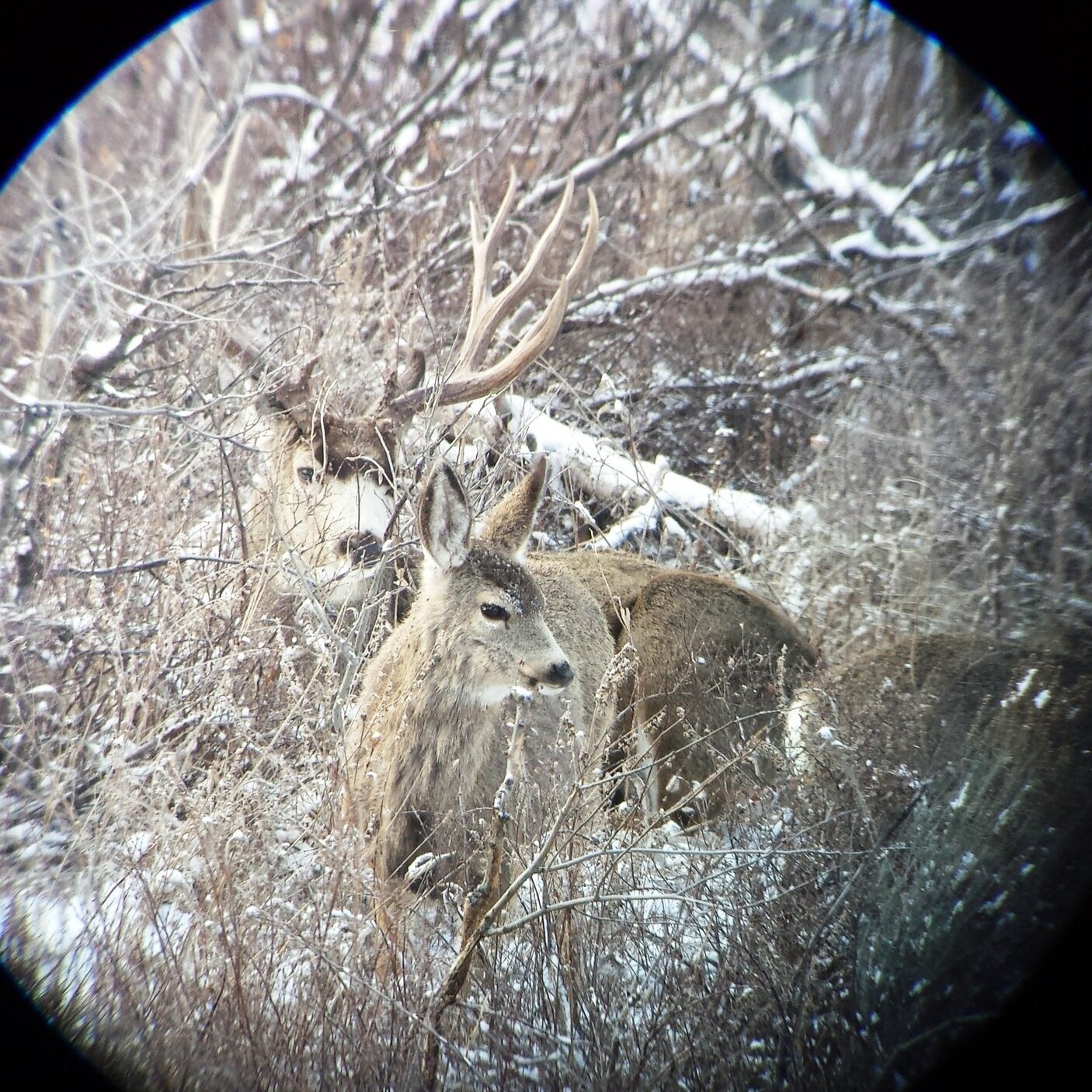
Mule deer buck and fawn just chillin in the snow. Photo by Morgan Graham.
Disclaimer
Due to the complexity of multiple jurisdictions, end users should not treat these data as authoritative. Data for unofficial reference purposes only. Data are updated annually. Every attempt is made to compile the most current information, however closure dates can be subject to change. Ex: In a heavy snow year, managers may respond by extending closures for an additional two weeks. You must rely solely upon official BLM, BTNF, CTNF, GTNP, NER, SNF, Teton County, WGFD, and WOSLI maps, personnel, and on-the-ground signage for complete and current winter travel regulations. These data are specifically intended for users accessing winter travel zones from Teton County, WY. Zones and routes extending outside of Teton County, WY are incomplete.
See Grand Teton National Park Seasonal Closures
See Caribou-Targhee Official Travel Maps
See Bridger-Teton National Forest Official Travel Maps
See Shoshone National Forest Official Travel Maps
See JH Conservation Alliance Don’t Poach the Powder (Additional Agency Maps)