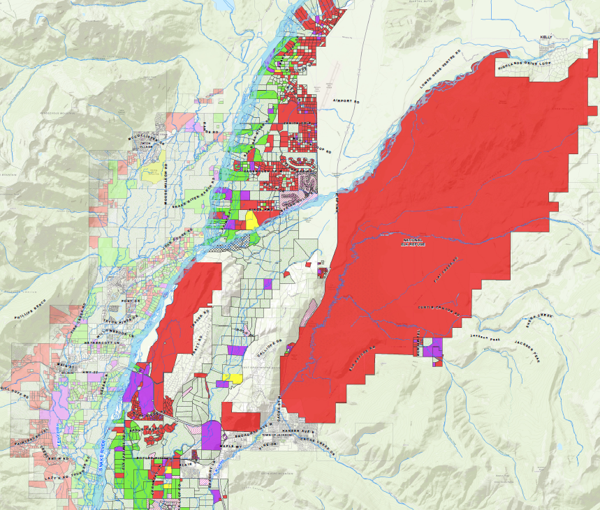

GEOGRAPHIC INFORMATION SYSTEMS (GIS)
Teton Conservation District staff specialize in geospatial data creation, analysis and cartography, and provide technical expertise and recommendations to decision makers to assist with natural resource conservation.